
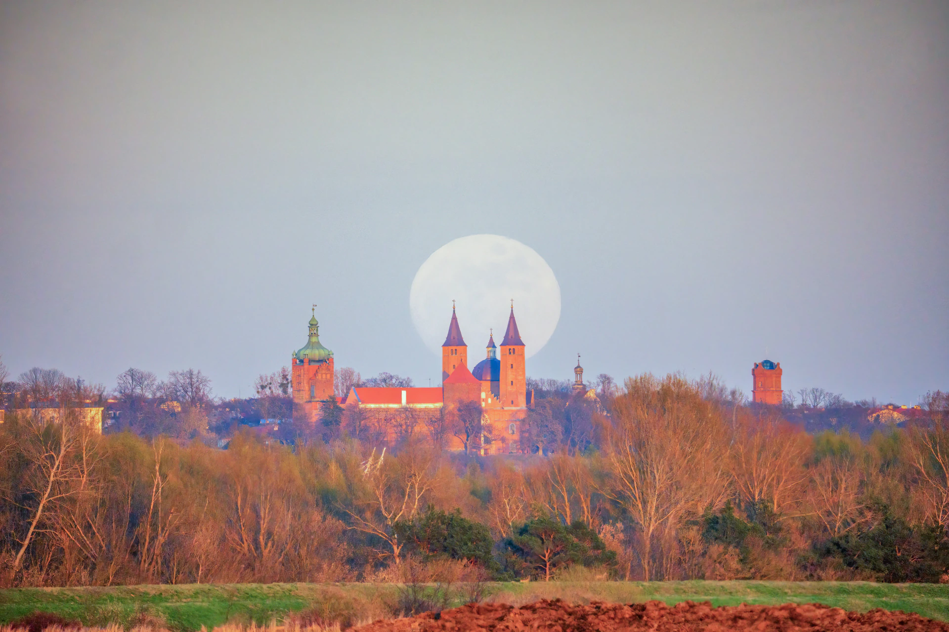
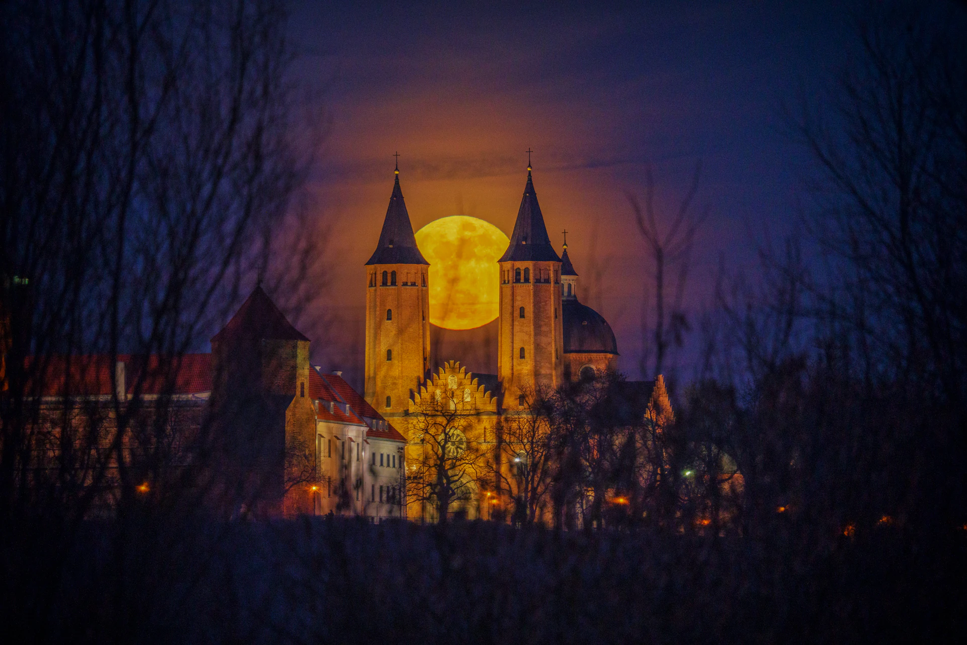
 600 mm · f/6.3 · 1/1000 s · ISO 1000
 April 1, 2026, Płock
Find a day worth heading out for, check whether the frame will actually work, save the plan - and come back to it when it matters. Less guessing, more shots that line up.
Free. Account optional. Data stays in your browser.
If you've ever arrived on location only to find the Moon rising in the wrong place, trees blocking your subject, or the spot making no sense at all, you already know how much guessing can cost.
Less guessing, more shots that actually work. A plan you come back to.
From picking a good day, through planning the frame, to coming back to the plan when it's worth heading out.
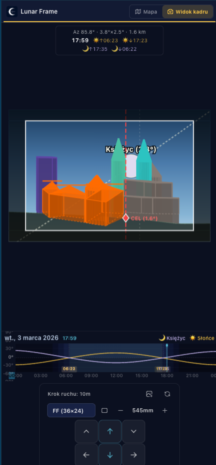
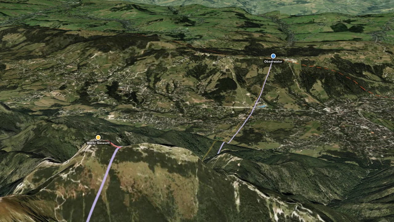
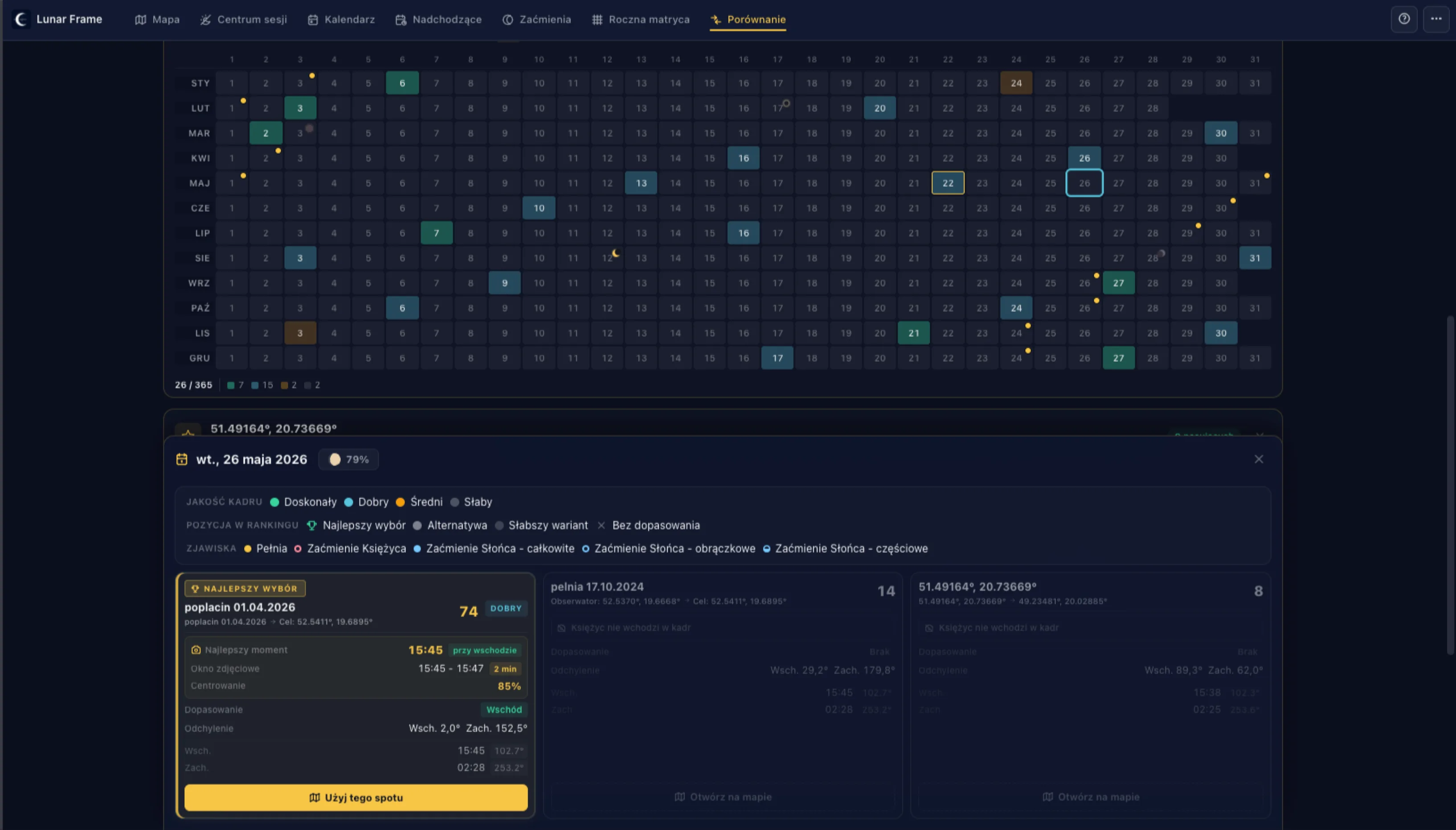
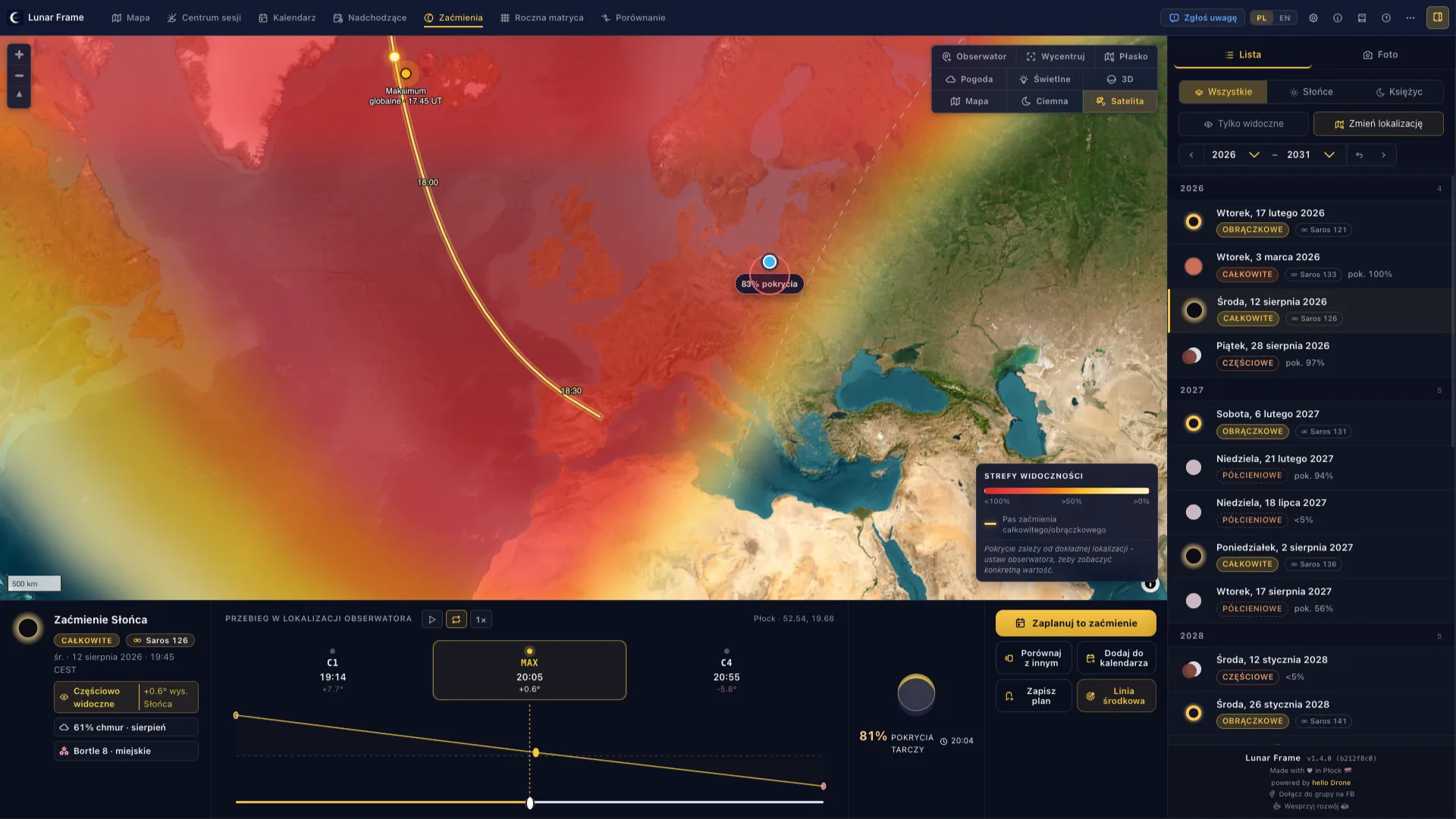
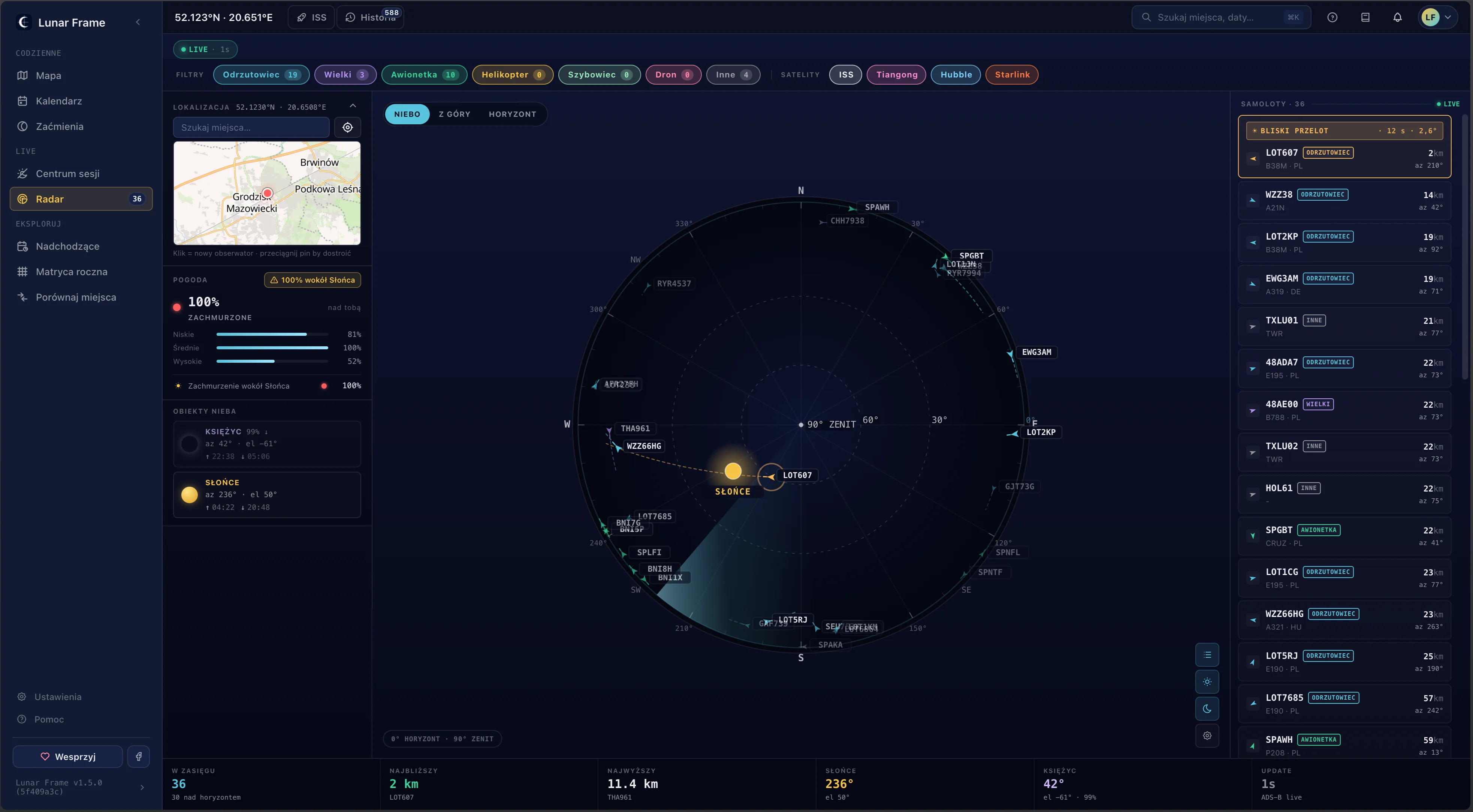
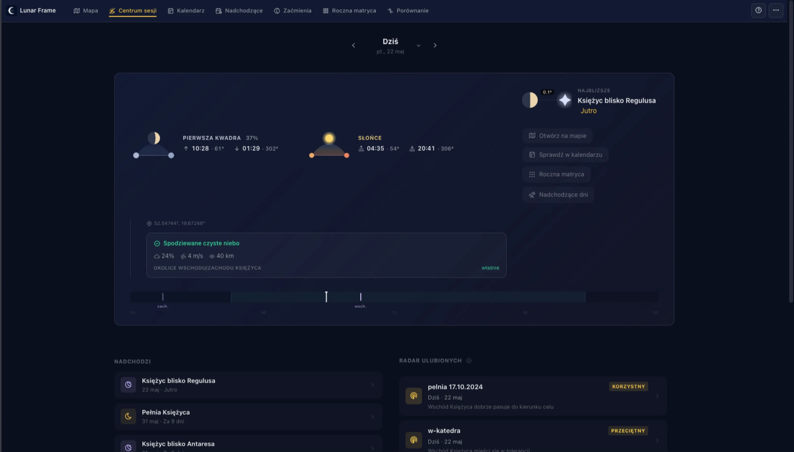
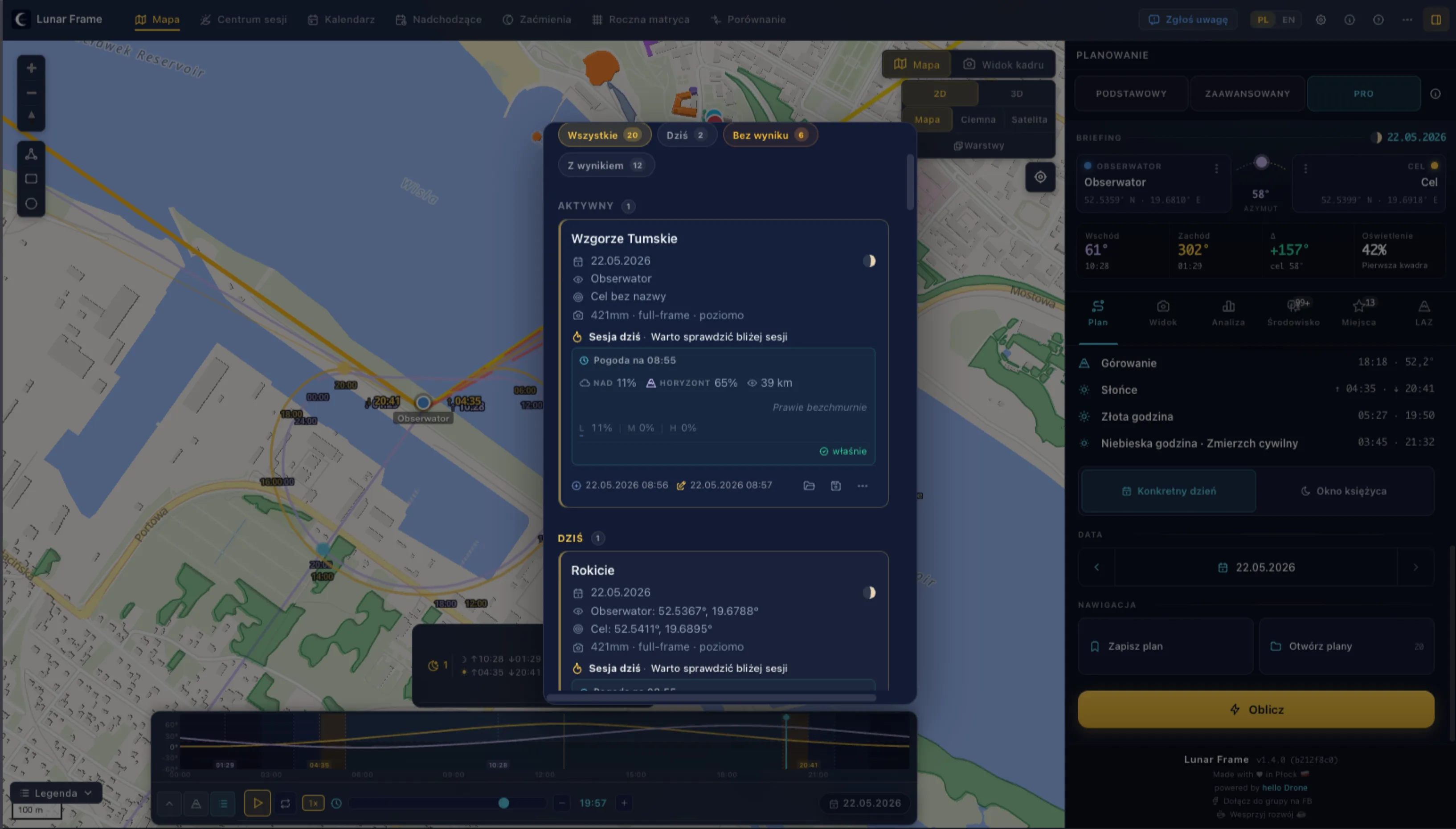
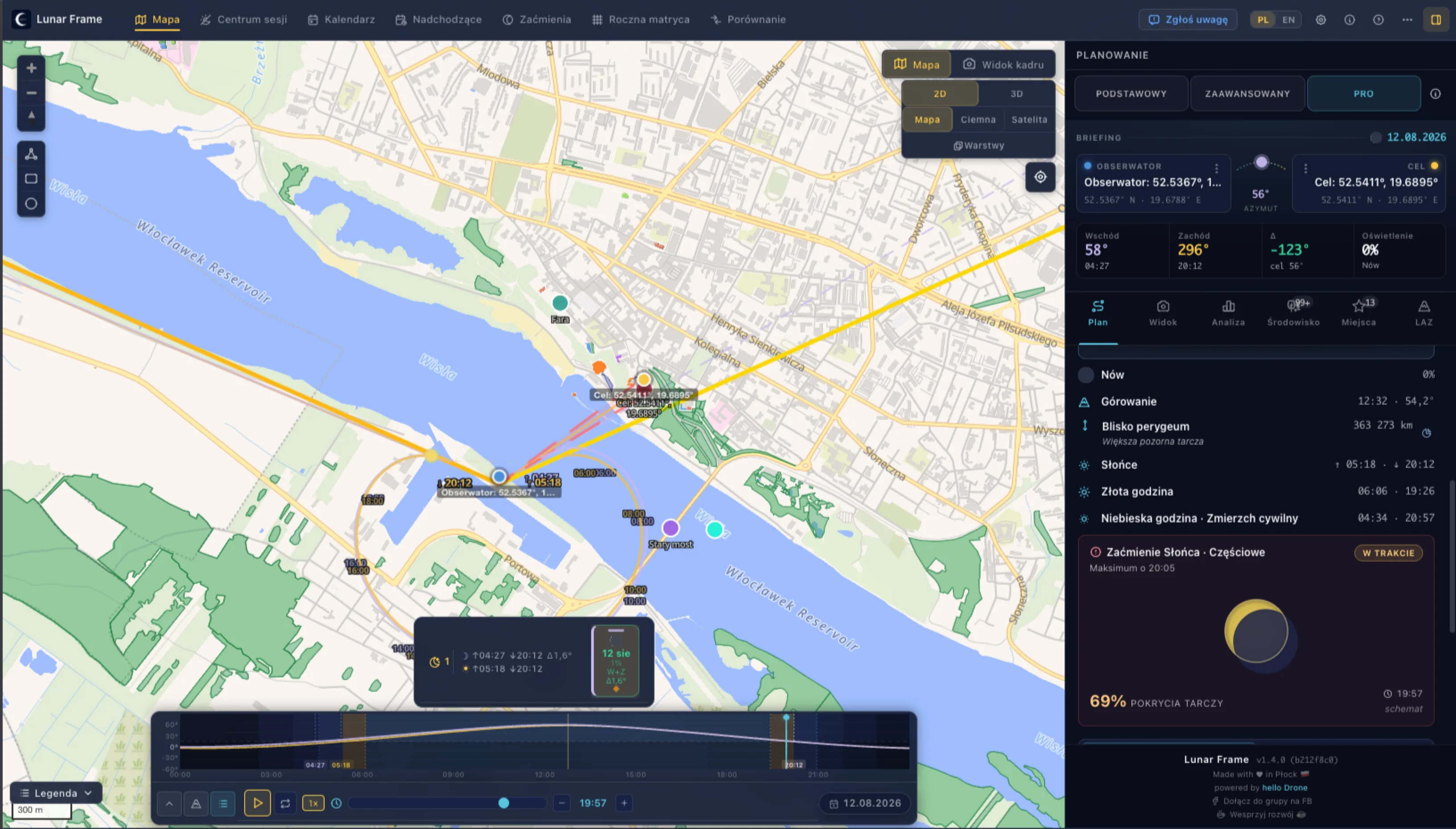
Set your observer and target, check direction, and quickly assess whether the scene makes sense before heading out.
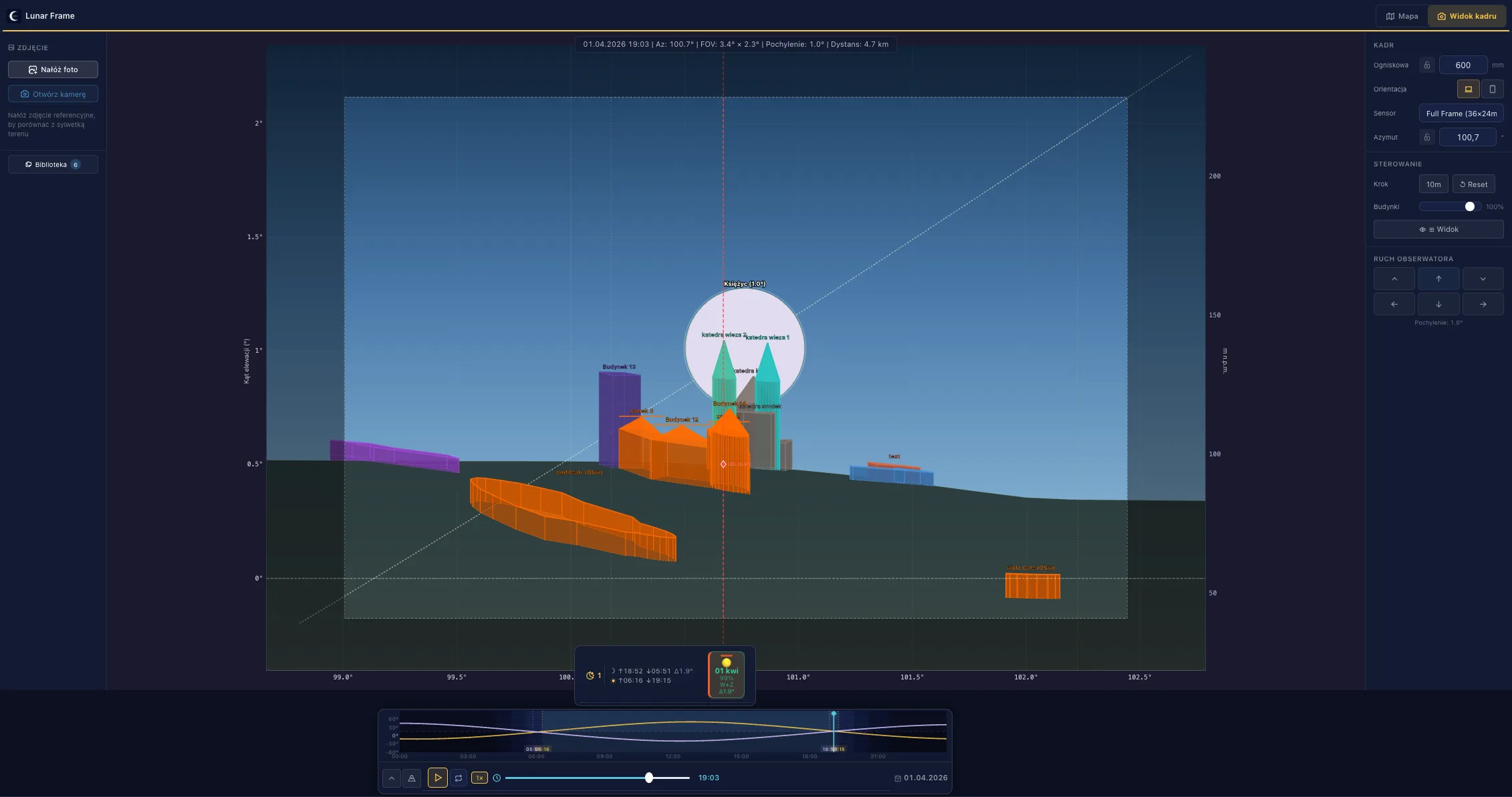
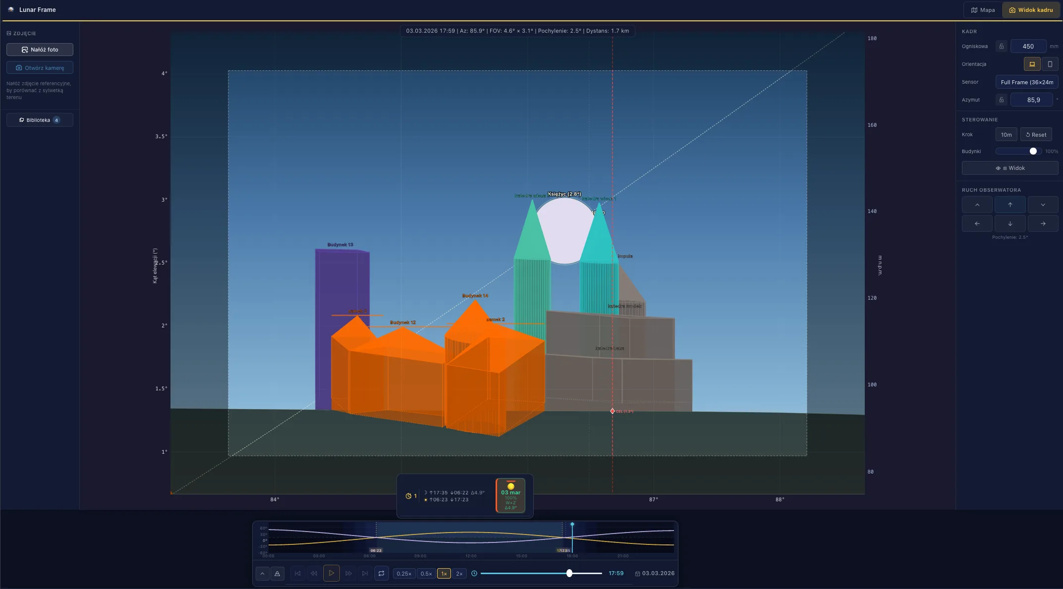
What you see in Lunar Frame matches what ends up on the memory card.
600 mm · f/6.3 · 1/1000 s · ISO 1000 April 1, 2026, Płock
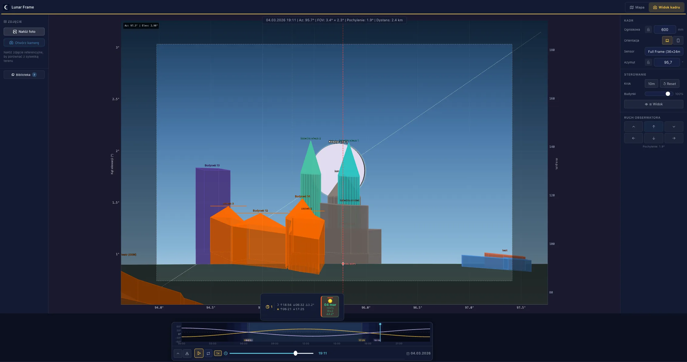
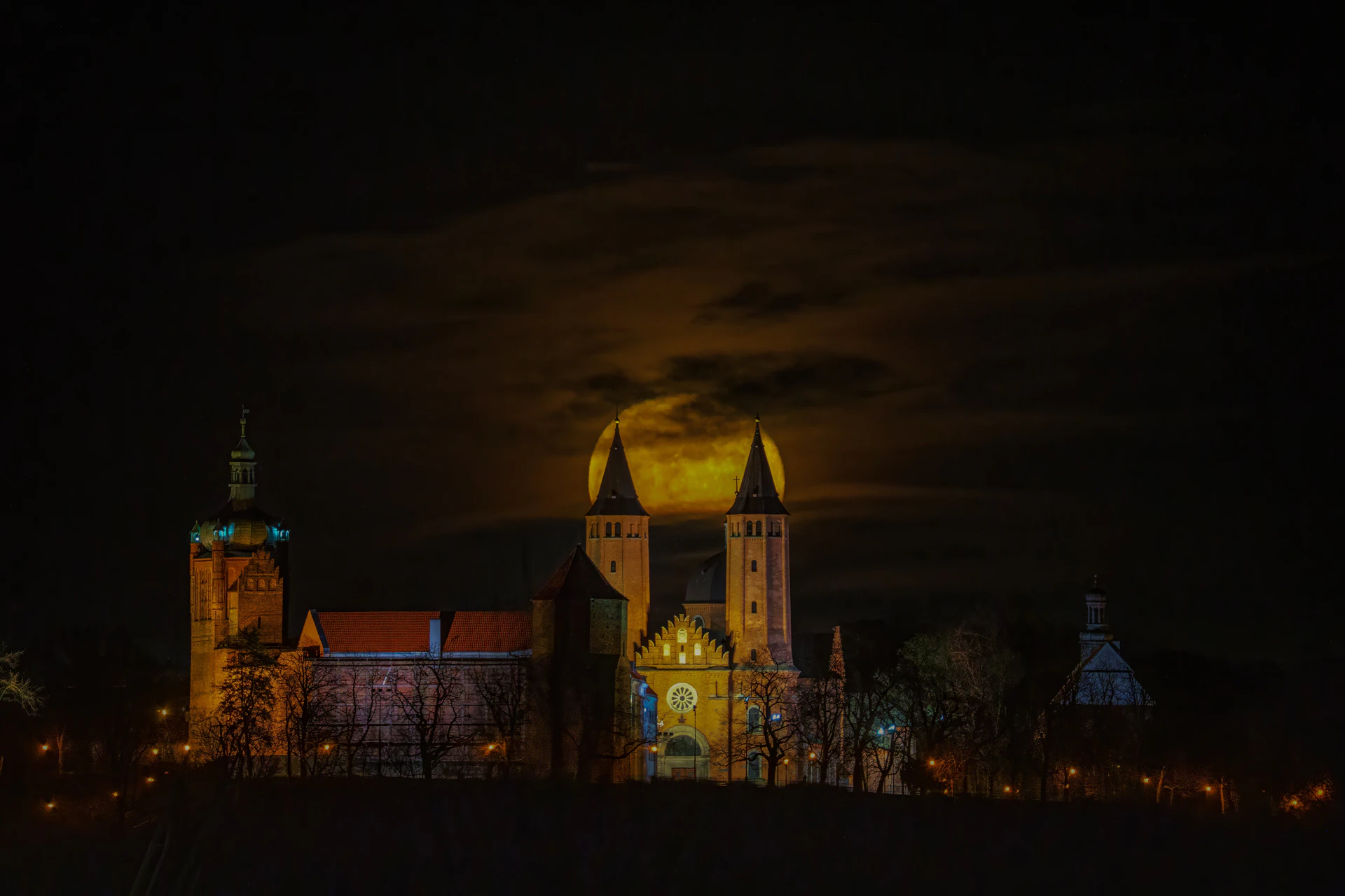 600 mm · f/6.3 · 1/25 s · ISO 3200
 March 4, 2026, moonrise
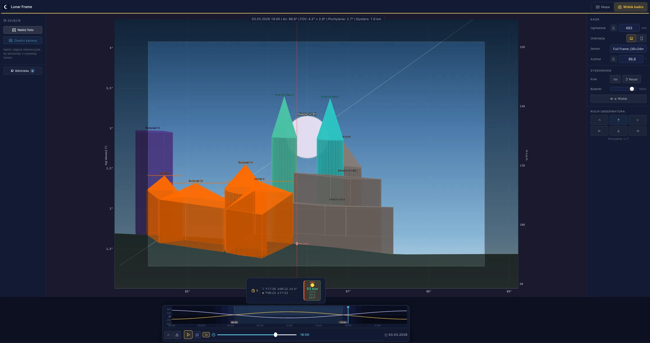
 493 mm · f/6.3 · 1/40 s · ISO 2000
 March 3, 2026, full Moon
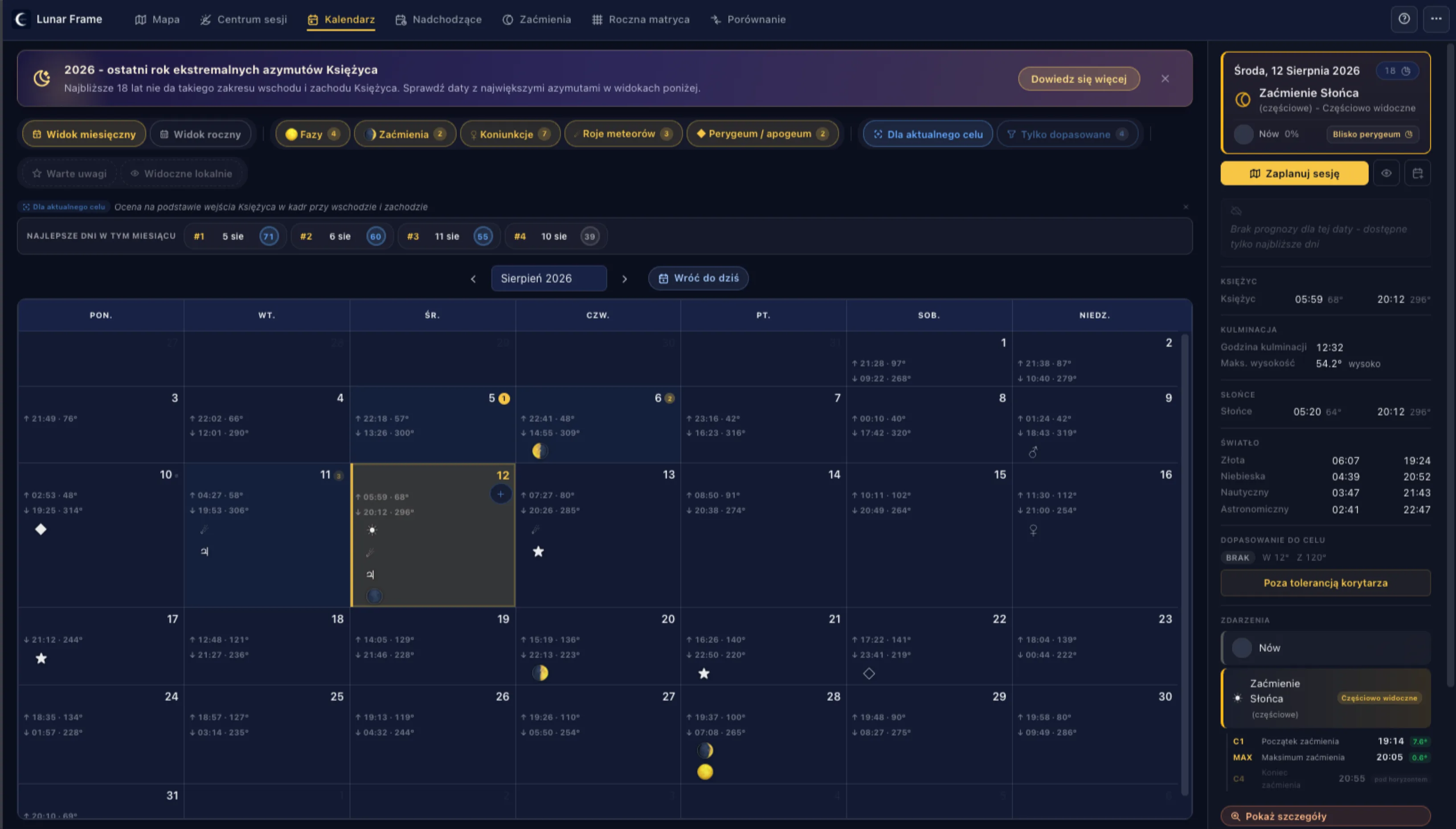
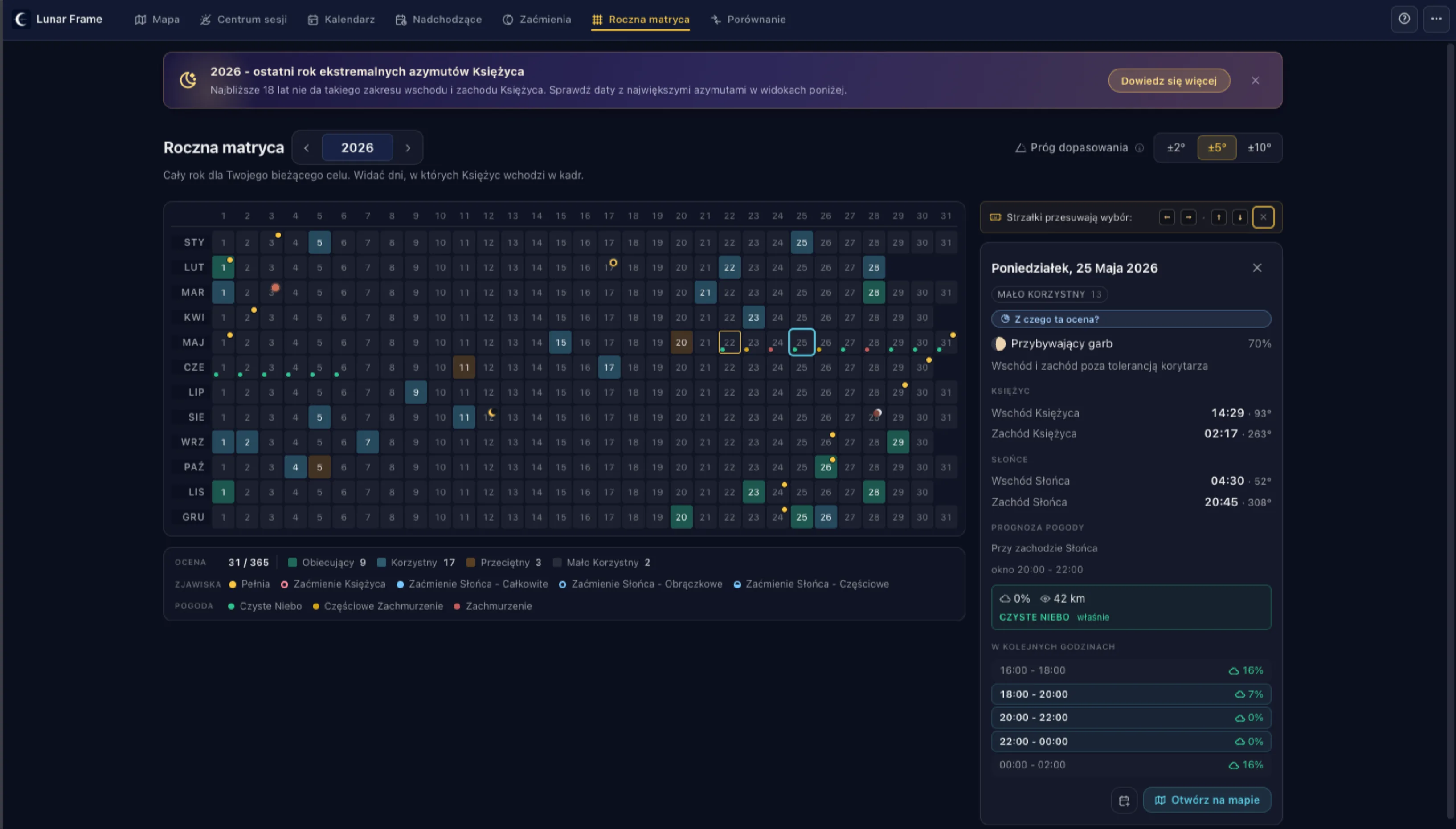
The calendar, the year matrix, and upcoming days show which dates make sense - before you dive into the details.
Pick the spot, the subject, and the lens. Check the terrain profile and the frame view - verify the shot actually works from your position.
The plan stays with you - it doesn't disappear when you close the tab. You come back to it whenever you want, and if needed, you can share a lighter setup.
The session hub shows what's live today and what's still open. After the shoot you log the outcome - the plan stays with you for next time.
From lining up the full moon behind a chosen subject to checking terrain, obstacles, and the actual frame view - all in one workflow.
Full moon behind a church, a crescent over a bridge, or the Moon above a hilltop. You pick the target and the app shows when and from where the shot makes sense.
Sunrise behind a monument, light between buildings, sunset down the axis of a street. You check exactly when and from where you'll catch the right direction.
Before you head out, you can evaluate the terrain profile, obstacles, and what could actually block the shot.
Save the plan - it stays with you. You come back, see what's live today, log the outcome after the shoot. Over time the plan becomes a record of what actually worked.
Maps from OpenStreetMap, terrain from AWS, astronomy from astronomy-engine. Everything based on proven, open sources.
You need no account to plan - one only helps when you want your plans on several devices. No ad profiles are built, and analytics runs on our own infrastructure - no external ad platforms involved.
Runs as a PWA on laptop, iPad, and phone. Plan at home; in the field you have what you actually need.
A few minutes of planning can save an entire wasted trip. The plan stays with you - you come back to it when it's actually worth heading out.
Free. No registration. No install - unless you want to.